5 Data Types - Vector vs. Raster vs. other types of spatial data
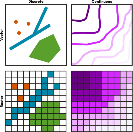
There are several data spatial data models that you may encounter as you work with spatial data. The two you will likely encounter most frequently are called vector and raster data.

5.1 Vector Data
Vector data represents discrete objects in the real world with points, lines, and polygons in the dataset.
If you were to draw a map to your house for a friend, you would typically use vector data - roads would be lines, a shopping center included as an important landmark might be a rectangle of sorts, and your house might be a point (perhaps represented by a star or a house icon).
5.2 Raster Data
Raster data represents continuous fields or discrete objects on a grid, storing measurements or category names in each cell of the grid.
Digital photos are raster data you are already familiar with. If you zoom in far enough on a digital photo, you’ll see that photo is made up of pixels, which appear as colored squares. Pixels are cells in a regular grid and each contains the digital code that corresponds to the color that should be displayed there. Satellite images are a very similar situation.